The Rural Opportunity Map Project
The Rural Opportunity Map was born out of the need for a new framework to understand opportunities in small town America in the 21st century – a framework that takes into account the way industry and employment are changing, and the demographic trends that have defined small towns for the past decade. The tool is meant to allow anyone - from nonprofit leaders to academics, Opportunity Zone investors to journalists - to find insight and opportunity in small town America.
These fully interactive maps show which rural areas are most primed for economic development strategies focused on digital economies.
Defining Rural
Exploring definitions of “rural”
There is no single definition of “rural.” In fact, there are more than 10 definitions of “rural” across federal agencies and national rural organizations. The definitions used by federal agencies, in particular, span three geographic units of analysis: census tract, county, and zip code. From population density to commuting patterns to adjacency to a metropolitan area, the definitions also take into account different variables.
Our Exploring Definitions of “Rural” Map captures the range of definitions used by the federal government, including the definitions of “rural” used by the Economic Development Agency, the Center for Medicaid and Medicare Services (CMS), the U.S. Census Bureau, and the U.S. Department of Agriculture, among others. This map provides a summary of these different definitions, as well as displays the geographies associated with each.
The map allows for more targeted exploration, too. There is a search field that can be used to determine whether a specific town or county meets each of the different definitions of “rural.”
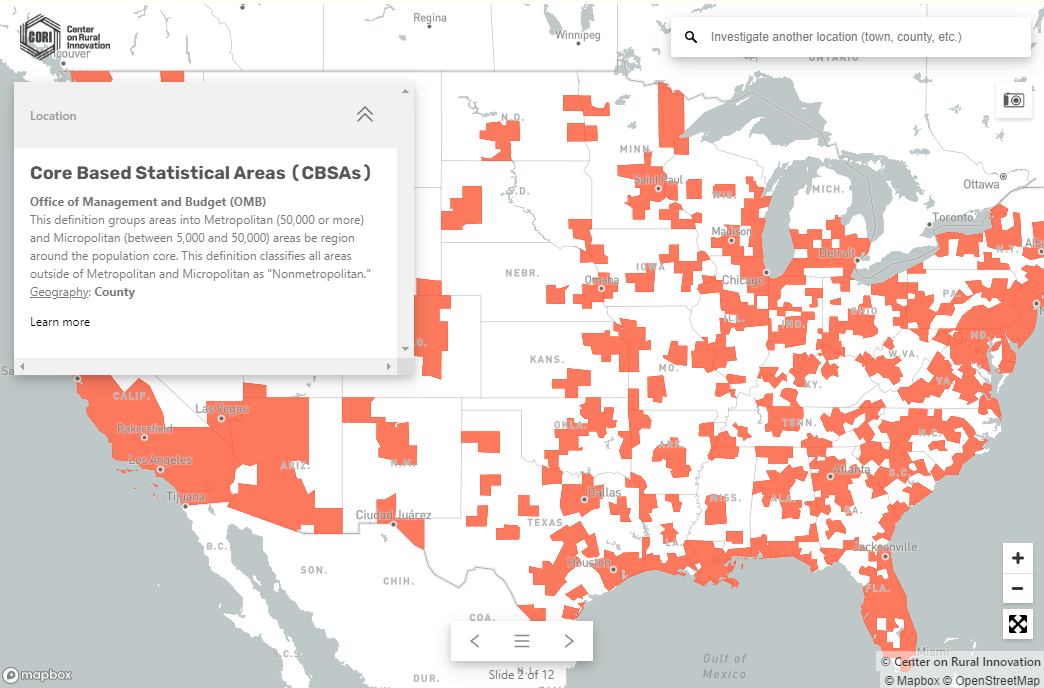
Use this map to:
Understand how different federal agencies define “rural”
Compare your own understanding of “rural” with the definitions used by a cross section of federal agencies
Identify communities in your area that meet specific definitions
Scouting Opportunities
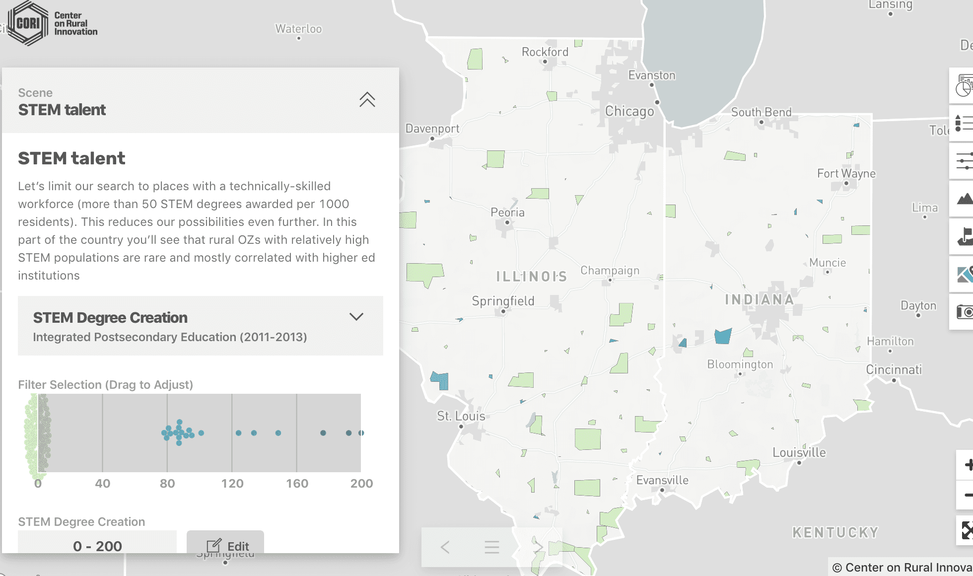
Scouting rural digital economy opportunities
The identification of rural communities that are primed for innovation and entrepreneurship requires a study of different variables.
These variables span demographics, such as population size and population trends over time, socioeconomics, and also what we consider to be direct drivers of digital economy ecosystems. This map allows for an exploration of these variables, among others.
This map is interactive, allowing customized filters to be applied to the available data. Whether it be type of higher education institution or strength of broadband infrastructure, the Scouting Rural Digital Economy Opportunities Map can be used to geolocate rural communities that have some of the direct drivers of an inclusive digital economy ecosystem.
This map can also be used to explore data about federal grants. All of the data underlying this map is downloadable.
Use this map to:
Explore and compare patent activity in rural communities
Determine whether or not a community has adequate broadband access
Identify communities with varying levels of digital economy drivers
Finding unique opportunities in rural America
Data for Action Map
Community leaders across rural America wanted a way to identify others facing similar economic challenges.
They specifically needed a tool that displayed not just data about their own town or region but one that could also identify communities that shared similar demographic, socioeconomic, and other characteristics. For example, are there other places within a state that have similar populations, median incomes and gigabit fiber? Or, are there places with similar median home value that are receiving more funding from the Department of Housing and Urban Development?
With this highly targeted insight about other communities, these leaders can identify peers who successfully tackled similar challenges. Or, they could build the case for why their own community was uniquely challenged in an effort to attract federal funding and philanthropic support.
With almost 40 variables spanning demographics, housing, economy, entrepreneurship, community assets and federal funding, the Data for Action Map fills this information and data void for rural leaders and others looking to identify opportunities across rural communities.
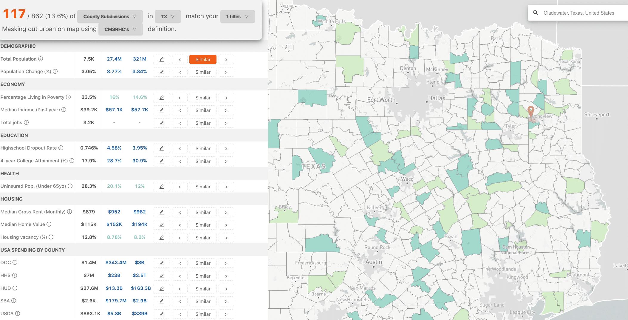
Use this map to:
See if your communities is considered rural by different definitions
Use filters to find communities with similar characteristics
Compare your community to others across 39 metrics
See federal funding details by community